

Scientists at Nanyang Technological University, Singapore (NTU Singapore) have developed a chip that allows new radar cameras to be made a hundred times smaller than current ones. With this... Read more

New satellite imaging concept proposed by University of Leicester-led team could significantly reduce search areas for missing boats and planes Concept uses satellite technology already in o... Read more

Scientists have demonstrated how new satellite technology can be used to count whales, and ultimately estimate their population size. Using Very High Resolution (VHR) satellite imagery, alon... Read more

Cameras fitted with a new revolutionary sensor will soon be able to take clear and sharp photos in dim conditions, thanks to a new image sensor invented at Nanyang Technological University (... Read more
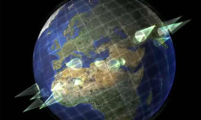
Small satellites capable of providing on-demand battlefield images Enemy fighters use commercial satellite images to plot attacks on U.S. troops, but most U.S. soldiers can’t get the s... Read more

We envision a constellation of small satellites … DARPA, the United States’ defense technology research agency that’s created such notable projects as the Internet you... Read more

Satellite imagery shows how palm oil plantations are displacing peatlands–at tremendous cost to the climate. The picture of Southeast Asia’s deforestation is coming into greater... Read more